Westhaven
Authors: Sylvia, Emily, Lauren, Erin, Chloe
Westhaven is a historically marginalized, majority-migrant neighborhood in Charlottesville, Virginia, situated at the base of a steep hill. This geographic condition has contributed to a range of environmental vulnerabilities—including poor drainage, water accumulation, extreme heat exposure, and related public health issues such as indoor mold and respiratory illnesses. The neighborhood's physical isolation, being tucked away from view of the main road, has long contributed to its social invisibility and disinvestment.
In addition to environmental risks, Westhaven is traversed by a high-speed through-traffic corridor, which has become notorious for drive-by shootings. This roadway, which prioritizes vehicle throughput over local safety, has emerged as a critical urban design and public safety challenge. Addressing this threat while improving environmental resilience was a key priority of our studio project.
Residents of Westhaven have been given the rare opportunity to help reimagine the layout and future of their neighborhood. As urban planning students, our role was to act as facilitators. By utilizing spatial tools, conceptual frameworks, and design knowledge we were able to empower residents to guide their own future through a participatory planning process. Recognizing that many residents have limited English proficiency, we produced an illustrated informational booklet that communicates key urban design concepts visually, helping to bridge language and literacy barriers.
Our team structured the site analysis around four interrelated planning and design dimensions: Passive Environmental Design, Green Infrastructure Strategies, Housing Typologies, and Public Space Activation. Each section aimed to address resident priorities through a lens of climate adaptation, livability, safety, and spatial justice. My primary focus was on passive design strategies, especially in response to local microclimatic conditions exacerbated by the neighborhood’s low-lying topography.
The chapter I led drew inspiration from the New York Times Sun and Shadow Mapping project, which demonstrated how solar exposure affects perceived safety, pedestrian activity, and real estate values in dense urban environments. While Westhaven differs significantly in urban form and density, the methodology offered a compelling lens through which to understand solar access and shading patterns in a neighborhood with significant topographic constraints.
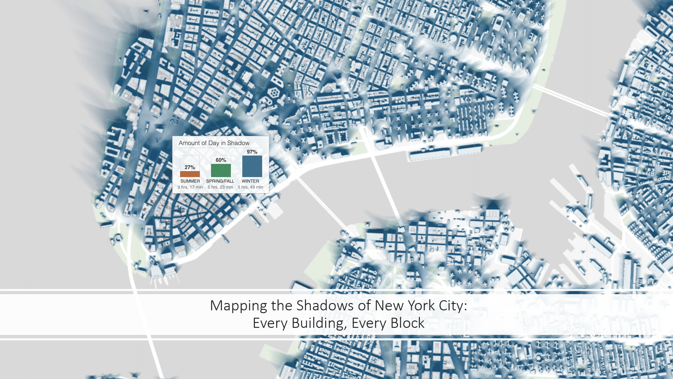
Source: New York Times
By conducting a localized solar and wind analysis, our aim was to explore how the placement and orientation of future housing could improve passive heating and cooling, reduce reliance on mechanical systems, and improve indoor air quality. Orientation strategies that maximize sunlight during winter while optimizing shade and cross-ventilation in summer can mitigate urban heat, enhance comfort, and reduce utility costs—critical considerations for a low-income community.
To support this analysis, I developed a sun and shadow simulation model using ArcGIS. The simulation accounted for the latitude of Charlottesville, topography, and existing built form to model solar exposure and shading across both summer and winter conditions. These findings helped inform our recommendations for climate-responsive site planning and building siting strategies that enhance health, safety, and energy efficiency
Summer Sun Shadow Analysis
Winter Sun Shadow Analysis
Our final deliverable was a community-oriented design guide: a visual booklet that explains core concepts such as green infrastructure, building orientation, cooling strategies, and safe streets in accessible, non-technical language. The booklet was distributed to Westhaven residents to support ongoing community-led planning efforts. You can view the full booklet here.