Cocoa Belt in Ghana
Authors: Sylvia Lam
This storymap analyzes the environmental conidtions in Ghana and the effects on cocoa production. As we face a changing climate, there is a need to look at potential challenges that may arise to better prepare and equip cocoa farmers to tackle these difficulties.
This storymap was made using ArcGIS online and environmental analysis such as land cover change using the Sentinel-2 Land Cover Explorer by Esri was carried using ArcGIS Pro. A vulnerability index was calculated to identify areas in Ghana that are most at risk in terms of the different environmental changes in temperatures, humidity, rainfall, and evapotranspiration. Lastly, the current efforts in cocoa production in Ghana over the years have been laid out to track and identify agencies that have been active in this area of work.
The Land Cover Change from 2017 to 2023 is an example of the raster analysis that was conducted and included in the ArcGIS Online Storymap. These are some of the raster images that were generated below:
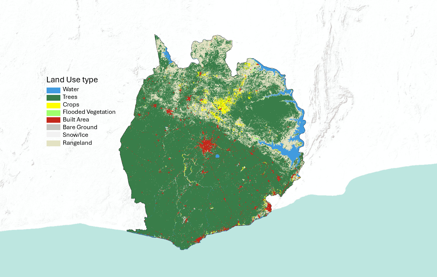
Land Use Raster Analysis 2017
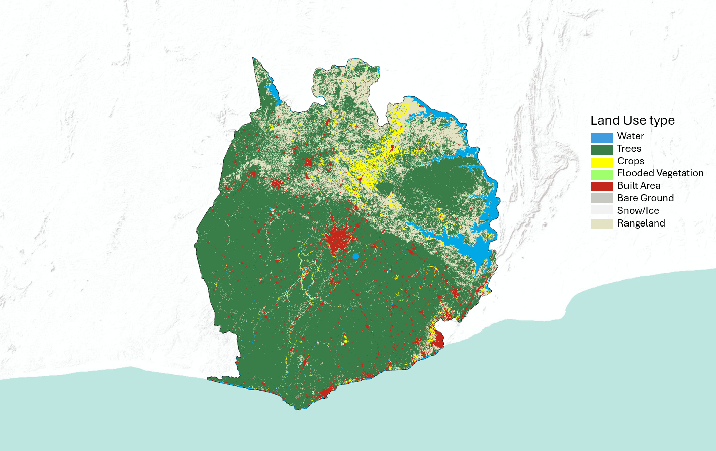
Land Use Raster Analysis 2023
The ArcGIS online storymap can be viewed here.