Pothole Detection and Road Classification
Authors: Sylvia Lam
This project leverages artificial intelligence to detect potholes on roadways and classify road types based on satellite imagery. The goal is to assess the urgency of road maintenance needs, particularly in the context of constrained budgets and limited resources. Roads with higher traffic volumes and vehicle speeds, such as arterial roads, pose greater safety risks and should therefore be prioritized for pothole repairs.
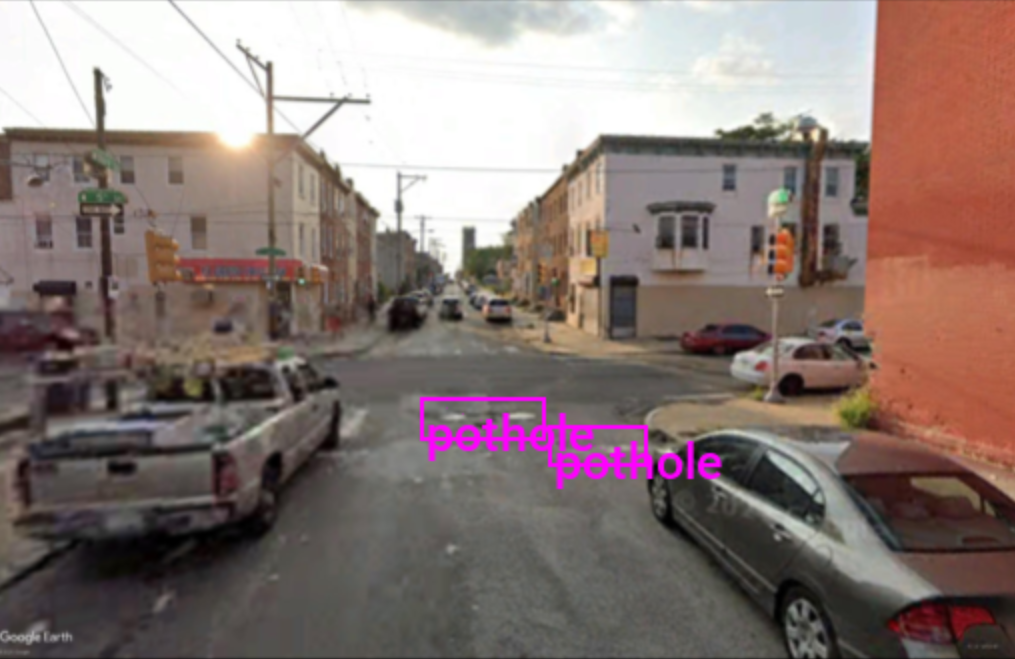
A dataset of 100 satellite images was sourced from Google Earth Engine and manually labeled using the Labelme application. These annotated images were used to fine-tune a Mask R-CNN model for pothole detection. An example of a labeled image is shown below:
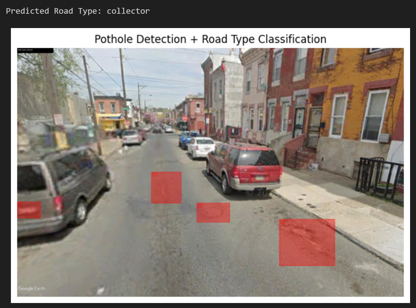
In addition to detecting potholes, the model was trained to classify roads into three categories: local, collector, and arterial. Arterial roads represent high-speed, high-volume traffic corridors; collector roads connect local roads to arterials; and local roads serve lower-speed, lower-volume residential traffic. This classification system helps prioritize maintenance efforts, focusing on roads where pothole-related hazards have the greatest potential to impact public safety. An example of the final output from the pothole detection and road classification tool is provided below:
The full project report is available here.
The Jupyter Notebook containing the implementation details can be viewed here.